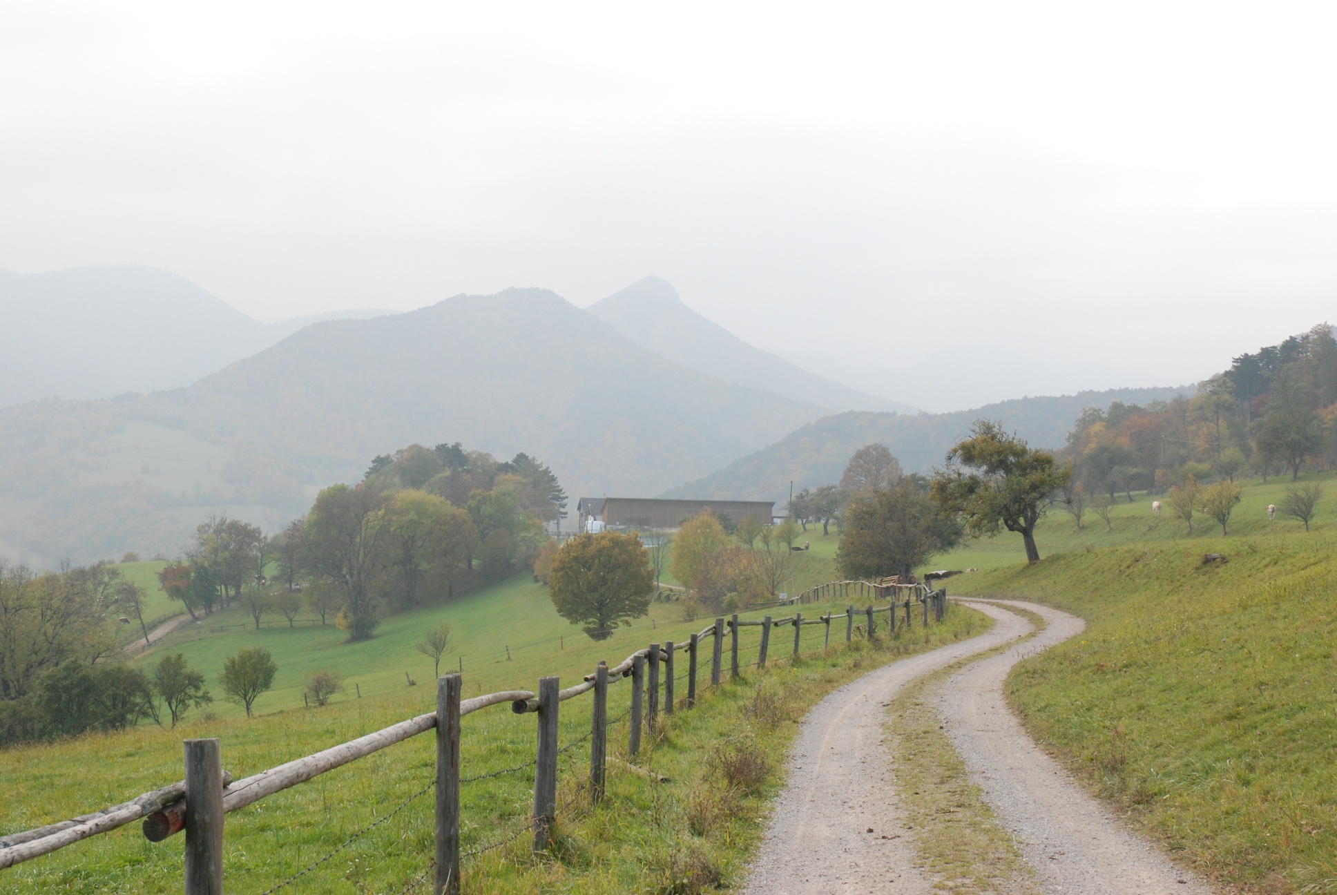
From Furth to the alpine Hocheck, 1,037 m
Use our AI guide
Do you have any questions about your stay?

Hiking tour Starting from Town of Furth an der Triesting; parking lot just past the town center on the right
ATTENTION: The Hocheck refuge is closed! From the idyllically situated hiking and recreation village of Furth, there are several tours to the 1000-metre peaks of the Gutenstein Alps and the Ö Voralpen - such as Hocheck, Kieneck and Almesbrunnberg. The classic ascent from Furth to the Hocheck leads surprisingly quickly to the summit with its viewing tower via the Krennweg trail. While you mostly hike through meadows and pine forests in the valley, you then climb higher through beech forests (which are currently falling victim to chainsaws on the flanks of the Hocheck) to finally enjoy fantastic views from the mountain peaks as far as Schneeberg, Rax and Ötscher. Back from the hikes, Furth lives up to its name "Valley of Innkeepers", as a wide range of culinary delights round off the nature experience.
ATTENTION: The Hocheck refuge is closed! From the idyllically situated hiking and recreation village of Furth, there are several tours to the 1000-metre peaks of the Gutenstein Alps and the Ö Voralpen - such as Hocheck, Kieneck and Almesbrunnberg. The classic ascent from Furth to the Hocheck leads surprisingly quickly to the summit with its viewing tower via the Krennweg trail. While you mostly hike through meadows and pine forests in the valley, you then climb higher through beech forests (which are currently falling victim to chainsaws on the flanks of the Hocheck) to finally enjoy fantastic views from the mountain peaks as far as Schneeberg, Rax and Ötscher. Back from the hikes, Furth lives up to its name "Valley of Innkeepers", as a wide range of culinary delights round off the nature experience.
The easternmost one-thousand-meter peak in the Alps can be easily reached by car via a toll road, but it is nicer to choose one of the 7 hiking trails that lead to the summit from all directions. The classic ascent from Furth to Hocheck leads via the "Krenn-Weg" to the lookout point, covering 615 meters in altitude. Even during the ascent, you can enjoy the increasing views, which are then surpassed by the 360° panorama from the Meyring lookout point at the summit. From here, you can see half of Lower Austria on a clear day.
On the way back, you initially hike through windswept beech forests before plunging back into the mixed forests of the middle altitudes at Mittagskogel and reaching Eberbach. On the last section of the trail across the pastures of Rehgras, you have another beautiful view of Furth and the surrounding mountains. All in all, this is a beautiful, varied circular tour.
Standard Hiking Gear
The hike starts at the large parking lot in the village of Furth. Follow the road 200 m back (past the toll road) to Rohrbach.
At a chapel under two linden trees, turn left into the Rohrbachgraben, following the ÖTK sign for “Hocheck via Krennweg” and the blue trail markers. Following the road past a carpenter’s shop, you’ll reach the “Pfefferhäusl.” Here, follow a meadow path along the valley floor to the toll road, then turn left into the forest immediately afterward. Continue along a forest trail at the edge of the valley until it rejoins the road on the right. From here, hike a short distance along the toll road until you reach the first prominent left-hand hairpin turn. Here, leave the toll road and stay to the right (in the direction of travel) of the stream. Staying close to the stream at all times, the blue trail markers lead you further into the Rohrbachgraben valley along a path. At the end of the valley, the trail turns left and crosses the stream, then climbs more steeply through the beech forest until it reaches a forest road.
Continuing to follow the blue markings, you now ascend rapidly along cart tracks and trails, crossing the toll road several times. Here, recently logged areas alternate with mature beech forest and young forest.
At the last switchback, where the summit meadow is already visible, you’ll join the toll road.
Hocheck – Mittagskogel – Eberbach
From the hut, head east to begin descending along a wide, rocky path following the red trail marker (No. 448) through a rugged beech forest. A flat stretch along the edge of the meadow offers more beautiful distant views. Descending to the left (north) of the ridge, you’ll soon reach a saddle where the trail to Altenmarkt branches off to the left. However, keep going straight ahead toward Mittagskogel (red marker 448), which you’ll pass to the south across a meadow. Shortly after this meadow, you’ll reach a saddle where the trails to Weissenbach and Eberbach branch off.
The trail straight ahead (red marker) continues on to Tasshof.
Follow the sign for “Eberbach, Weissenbach” and the red marker No. 448 to the right, descending on a wide forest path through mixed woodland to a small clearing at an elevation of 727 m (Prinzwiese). Here, turn left and descend steeply—and in places over rocky terrain—in a ditch, continuing to follow the red markings. Continue downhill on a forest path until you reach a forest road. Cross this road and follow Trail No. 448 further, descending somewhat more steeply in the ditch until you come to a forest road. Follow this road down the valley until just past a right-hand hairpin bend. Here, turn left onto a path and continue following Trail No. 448, marked in red, down the valley. Soon you’ll reach the meadows and orchards and the first houses of Eberbach. Stay on the marked trail, passing north of the village until the trail leads down to the road on the right.
Eberbach- Furth
In Eberbach, follow the sign “Rehgras-Furth, blue then green” along the road for about 450 m down the valley, following the red and blue markings along the stream. On the right, a bridge now crosses the stream, and the sign “Rehgras-Furth, blue then green, 06A” indicates the way forward. Cross the bridge and follow the paved road for 100 meters, then turn left onto a forest road (blue arrow, “Private Road”). This forest road now climbs gently and steadily, marked in blue, toward Guglhof. After about 1.3 km, before reaching a meadow, a narrow path branches off to the left of the forest road. Here, follow the blue arrow and the sign “Rehgras-Furth, blue then green, 06A” through the forest, ascending to the highest point of the return route. At the edge of the forest, you’ll come to the forest road (= the path from Weissenbach to Furth, marked in green), which leads to the right across the meadows to the Rehgras farm.
The trail continues straight ahead through the center of the Rehgras farm to a green iron gate. Passing along a wooded area and past a cross, head straight downhill across meadows with a beautiful view of Furth and the Further Mountains until the trail continues between two wooden fences.
After a short stretch through the forest and crossing a small stream, you’ll reach a paved road that leads directly down to Rohrbach. Follow the road for a short distance back to the starting point.
Right in Rohrbach, 50 meters before the turnoff for the toll road, or—better yet—at the large parking lot in the town of Furth, turn right after the church (about 150 meters past the toll road)
Parking Note: Please follow local parking regulations and check for any parking fees or time restrictions. We recommend checking the parking situation in advance to ensure a stress-free arrival.
Take the Leobersdorf exit on the A2 Südautobahn, follow the Hainfelder Bundesstraße B 18 to Weissenbach, turn left toward Furth, and once inside Weissenbach, turn left again onto Further Straße and continue to Furth
Travel Advice: Please check the route to the meeting point in advance and allow plenty of time. Be aware of possible traffic delays, road construction, or public transportation disruptions.
Leider können wir Ihnen zum jetzigen Zeitpunkt keine Wetterdaten für den Ort anzeigen.
Wienerwald Tourism
3002 Purkersdorf, Hauptplatz 11
Tel. 02231/621 76
office@wienerwald.infooffice@wienerwald.info
www.wienerwald.info
Leader Region Triestingtal
2560 Berndorf, Leobersdorfer Straße 42
Tel/Fax 02672-87001
office@triestingtal.atoffice@triestingtal.at
www.triestingtal.at
Letzte Änderung: 6 Aug 2026