Alpannonia Scenic Route: Feistritzsattel – Hochwechsel
Use our AI guide
Do you have any questions about your stay?

Hiking tour Starting from Feistritzsattel State Highway
From the Feistritzsattel to the Hochwechsel
From the Feistritzsattel to the Hochwechsel
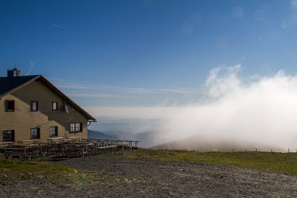
From the Feistritzsattel, the trail climbs gently via Schwaigen (alpine pastures) to the 1743m high Hochwechsel with the Wetterkoglerhaus. On the Hochwechsel you can see practically the entire route of the main alpannonia trail: from the first stages in the Styrian mountains and from the Sonnwendstein to the Hungarian plain.
How to Behave When Encountering Grazing Animals:
www.alpannonia.at/verhaltenstipps-fuer-wandergaeste-auf-beweideten-almen
When choosing a route, make sure it matches your mountaineering experience and physical fitness. Check the weather forecast in advance. The weather in the mountains can change surprisingly quickly. Therefore, always set out with the appropriate gear (e.g., rain gear).
Check whether the huts and snack bars you plan to visit along the way are open. Let someone know your route and your planned return time before you set out.
Cross-border hiking trail: Remember to bring a passport or ID card!
Always bring appropriate maps with you. Wear sturdy shoes suitable for the hike, and bring sunscreen, rain gear, water, and a light snack. Bring your cell phone and save the mountain rescue emergency number: 140
Preferably in Trattenbach, though it's also possible at the Feistritzsattel (please note that cell phone reception is poor in the area)
Take the S6 to Gloggnitz, then continue via Otterthal to Trattenbach, or take the A2 to Grimmenstein or Apang/Markt, Kirchberg am Wechsel, Trattenbach
Take the train to Gloggnitz, then continue by bus to Trattenbach
More information on getting there: Traveling by public transportation to the Vienna Alps