
gpx_addressbase_17336
Circular hike tip on the Wiener Alpenbogen around Puchberg
Hiking tour Starting from Puchberg am Schneeberg train station
- Difficulty: Moderate
- Distance: 22,32 km
- Duration: 7:00 h
- Ascent: 880 m elevation gain
- Descent: 880 m elevation gain
Demanding day tour along the Wiener Alpenbogen - Arc of the Viennese Alps (trail) and its regional routes. The tour leads from Puchberg am Schneeberg to the foot of the Schneeberg, to the Öhler and back again.
- Starting point of the tour
- Puchberg am Schneeberg train station
- Tour destination
- Puchberg am Schneeberg train station
- Difficulty: Moderate
- Distance: 22,32 km
- Duration: 7:00 h
- Ascent: 880 m elevation gain
- Descent: 880 m elevation gain
- Fitness level required:4/6
- Overall experience:4/6
- Scenery:4/6
- Lowest point575 m
- Highest point1247 m
- Round tour
- Nice views
- With refreshment stops
- Accessibility by train and bus
Demanding day tour along the Wiener Alpenbogen - Arc of the Viennese Alps (trail) and its regional routes. The tour leads from Puchberg am Schneeberg to the foot of the Schneeberg, to the Öhler and back again.
The climatic health resort of Puchberg am Schneeberg is the start and end point of this day tour at the foot of Schneeberg, Schober and Öhler. On the regional Route P, we hike on farm tracks with the Mariazell pilgrims in the direction of Losenheim and climb the Fadensattel at the foot of the Schneeberg. Alternatively, you can take the chairlift (see author's tip). Via the Dürre Leiten we reach the alpine meadows of the Mamauwiese and a trade route that is over 2,000 years old, before we come face to face with the rugged Schober and its neighbor Öhler. We hike uphill to the Öhlerschutzhaus before beginning the descent on the regional Route Q to Puchberg and our starting point.
Safe on the mountain
Your hikes in the Wiener Alpen should be a thoroughly beautiful and safe experience. Please observe the following:
Preparation
Make sure when choosing the route that it matches your experience and fitness. Check the weather forecast beforehand. Weather in the mountains can change very quickly and unexpectedly. Therefore, always go properly equipped (e.g., rain protection).
Check if the huts and snack stations you want to visit on the way are open. Inform someone about your chosen route and planned return before you set off.
Always take suitable maps with you. Wear sturdy shoes appropriate for the route, bring sun and rain protection as well as water and a small snack. Take your mobile phone with you and save the emergency number of mountain rescue: 140
The challenging circular hiking route starts at the Puchberg am Schneeberg train station, where we walk a few meters alongside the tracks back to Wiener Neustädter Straße. Ahead of us, we see the certified hiking operation Hotel Schneeberghof, where you can stay overnight if you arrive the day before and start the day with a tasty hiking breakfast. At the road, we turn north and cross the railway tracks. Shortly after, we turn left onto Siebertweg and follow the yellow signpost towards Losenheim. From here, for several kilometers, the red-marked Burgenland Mariazell route also accompanies us. At the end of Siebertweg, we turn right onto Paradiesweg and just seconds later continue left onto Römerweg. At some resting benches, a signpost leads us half-right off the road across a pasture. We continue walking west on quiet asphalt and gravel roads until the Mariazell route leaves us to the right at a junction with a transformer station. We follow the asphalt road to the left, which merges into the road to Losenheim after two curves. In the Sonnleiten settlement, we follow the road to Wasserfallwirt. However, shortly after a gravel car park at a farm, we leave this road to the left over the Sebastianbach and follow the yellow markings. Step by step, we get closer to Schneeberg, ultimately ending up back on the road to Losenheim. To the left towers the Losenheim Ruin, which has been privately restored since the 1990s. A visit is possible for groups of five or more by appointment. We reach the village of Losenheim with the hiking hotel Forellenhof but do not go directly into it; instead, we leave it just before the first houses half-right onto a hiking trail. The hiking path, marked blue, gently climbs near the Losenheim stream to a junction where we turn left back to the road and then right to the parking lot of the Salamander chairlift. Here there is the option to shorten the ascent with the chairlift. However, we hike uphill to the end of the road and take the marked yellow ascent path to the Edelweißhütte.
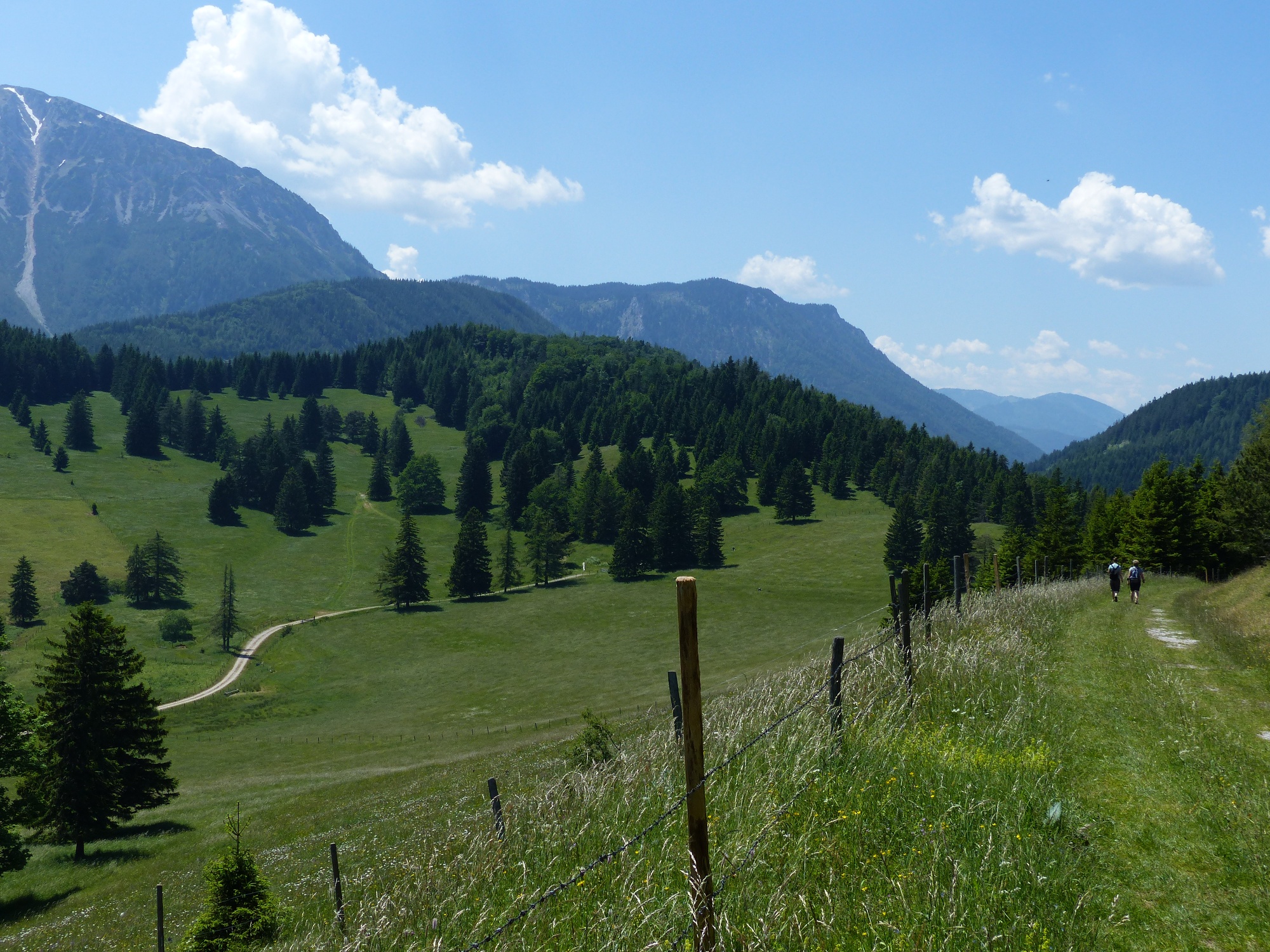
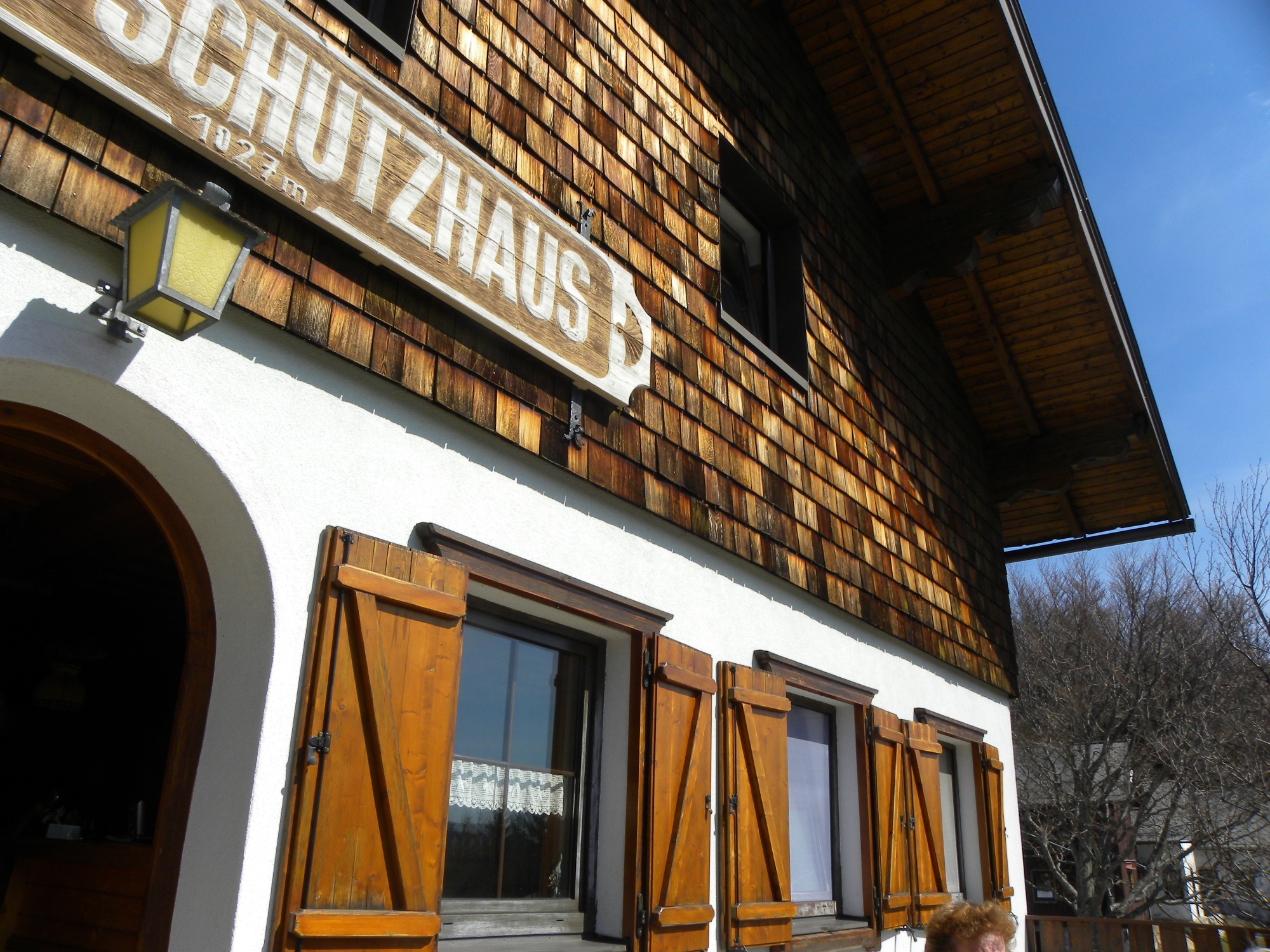
After some switchbacks, ski ascents, and crossing a pasture, the gravel path briefly becomes flatter. To the left is the Edelweißhütte at the foot of the Fadensteig, which invites you all year round for a rest and meal. The further path leads us with our back to Schneeberg past the Almreserlhaus along the signposted main route of the Wiener Alpenbogen over the Dürre Leiten to Mamauwiese. Here we briefly meet the Mariazell route again, which crosses Mamauwiese westward on a documented Roman road; we take the marked path east to the Öhlerschutzhaus. Over a cattle path and a pasture, we cross a small ridge before a fantastic view of Schober and Öhler is presented to us. Descending slightly, we stroll over gentle meadows to the gravel road and turn right here. Past Schoberhof, we turn left off the road at a refreshing spring fountain and follow the marked hiking trail steadily ascending under the Öhler rock walls to the Öhlerschutzhaus. Here again is the opportunity to rest and enjoy Öhler dumplings on the cozy terrace or in the warm room (closed Mondays and Tuesdays). After looking through the stationary Wiener Alpen-Viewer to Unterberg and Mariahilfberg, we begin the descent on the regional route back to Puchberg. The green Wiener Alpen logo marks the descent path, and the blue markings assist us in orienting during the descent. Only at Haltberghof do we walk on an asphalt road again and mostly along Schoberbach back to the station in Puchberg.
Parking spaces available at the Puchberg am Schneeberg train station.
If coming from Vienna and Graz, take the A2 to the Wiener Neustadt West exit. Take the B26 to Puchberg am Schneeberg.
Travel by train, for example via Wiener Neustadt, directly to Puchberg am Schneeberg.
More info at: www.oebb.at
Culinary delights are not neglected on this hike. Countless places to stop offer food and drink; you only need to know the opening hours of the individual establishments. Thanks to the Schneeberg chairlift, the ascent to the Edelweißhütte can be made easier. The operating hours are daily from 8:30 a.m. to 5:00 p.m. in summer; in spring and autumn, the chairlift only runs on weekends and holidays.
If you want to take it very easy, you can also stay overnight at the Edelweißhütte or the Öhlerschutzhaus. Sure-footed summit challengers can also cross Schober and Öhler to the Öhlerschutzhaus (yellow marked path).
Recommended period
J
F
M
A
M
J
J
A
S
O
N
D
Wiener Alpen in Lower Austria, www.wieneralpen.at, +43 / 2622 / 78960
Tourism office Puchberg am Schneeberg, www.puchberg.at, +43 / 2636 / 2256
Schneeberg chairlift, www.schneebergsesselbahn.at +43 / 2742 / 36 099 099
Hotel Schneeberghof, www.schneeberghof.at
Letzte Änderung: 20 May 2026