Mönichkirchen Village Walk
Use our AI guide
Do you have any questions about your stay?

Hiking tour Starting from Mönichkirchen Municipal Office
"Tut gut" footpath of the municipality of Mönichkirchen
"Tut gut" footpath of the municipality of Mönichkirchen
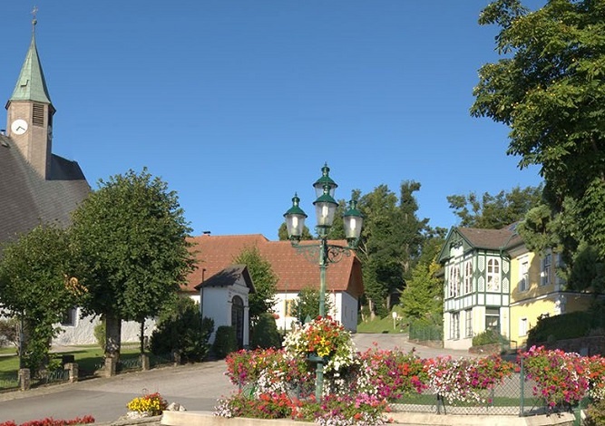
Start at the municipal office, along Oststraße towards the southern entrance to the Wildganspromenade with numerous avenue trees. Continue along the housing estate to the church square with the Maria Namen pilgrimage church, a little uphill along the signs and back to the municipality.
Always bring appropriate maps with you. Wear sturdy shoes suitable for the hike. Bring your cell phone and save the mountain rescue emergency number: 140
Preparation
When choosing a route, make sure it matches your experience and fitness level. Check the weather forecast in advance. The weather in the mountains can change surprisingly quickly. Therefore, always set out with the appropriate gear (e.g., rain gear).
Check to see if the restaurants you plan to visit along the way are open. Let someone know your route and your planned return time before you set out.
Parking is available at the municipal office (the starting point of the route)
From Vienna: Take the A2 Südautobahn through the Pittental valley to the Edlitz-Aspang exit, then continue on the B54 federal highway toward Aspang and on to Mönichkirchen.
From Graz: Take the A2 Südautobahn to the Zöbern exit toward Aspang—then continue to Mönichkirchen via the B54, or take the Pinggau exit and follow the B54 federal highway.
From the Aspang-Markt train station, take bus line 371 to the Hotel Thier bus stop—from there, you can start the walk right away toward the cemetery and Anton Wildgans Allee
Tour Highlights:
Maria Namen Pilgrimage Church
122 trees lining the avenue and the village street adorned with flowers
Anton Wildgans Promenade with a view of the rolling foothills
Mountain resort town center with history and charm
Numerous Wildgans plaques with witty texts create a charming connection to the town—a hidden gem!
Forest villas along the path are a testament to sophisticated summer retreats
More information:
For a longer stay, we recommend the Hotel Thier, the Sonnenhof Hechtl, or the Gasthaus Dreiländerblick.
For a quick bite, try the Kirchenwirt or the Dorfstetter Bakery.
Mönichkirchen Adventure Alpine Hut
Letzte Änderung: 3 Aug 2026