Enzesfeld "Pfarrkogel" Hike
Use our AI guide
Do you have any questions about your stay?

Hiking tour Starting from Parking lot at the Enzesfeld Cemetery
The market town of Enzesfeld-Lindabrunn is located on the eastern edge of the Lower Austrian Prealps, where the last hilly foothills descend into the Vienna Basin, on the so-called thermal line. Accordingly, the influence of the Pannonian climate is already strongly noticeable here, which can also be seen in the vegetation, predominantly black pine forests and oak forests, beech forests only on cooler northern slopes, as well as in the many vineyards. For hikers, the municipality offers many possibilities, all of which can be classified as rather leisurely, even on longer routes, as there are only a few meters of altitude to overcome. You can hike the highest mountain in the municipality, the Pfarrkogel (470 m), the Guglzipf (472 m), which is Berndorf's top excursion mountain with a lookout tower and huts, as well as the extensive forest landscapes between the municipality and Aigen. No visitor should miss out on a walk along the grounds of the symposium (dry grassland Natura 2000 area, permanent sculpture exhibition, view). On your return from the hike, you can either stop off at one of the inns or visit one of the rustic wine taverns in Lindabrunn or Enzesfeld. The hikes presented here are also easy to do if you arrive by public transport (Enzesfeld train station). The best way to get to the starting point in Lindabrunn is via the Frauentalkreuz.
The market town of Enzesfeld-Lindabrunn is located on the eastern edge of the Lower Austrian Prealps, where the last hilly foothills descend into the Vienna Basin, on the so-called thermal line. Accordingly, the influence of the Pannonian climate is already strongly noticeable here, which can also be seen in the vegetation, predominantly black pine forests and oak forests, beech forests only on cooler northern slopes, as well as in the many vineyards. For hikers, the municipality offers many possibilities, all of which can be classified as rather leisurely, even on longer routes, as there are only a few meters of altitude to overcome. You can hike the highest mountain in the municipality, the Pfarrkogel (470 m), the Guglzipf (472 m), which is Berndorf's top excursion mountain with a lookout tower and huts, as well as the extensive forest landscapes between the municipality and Aigen. No visitor should miss out on a walk along the grounds of the symposium (dry grassland Natura 2000 area, permanent sculpture exhibition, view). On your return from the hike, you can either stop off at one of the inns or visit one of the rustic wine taverns in Lindabrunn or Enzesfeld. The hikes presented here are also easy to do if you arrive by public transport (Enzesfeld train station). The best way to get to the starting point in Lindabrunn is via the Frauentalkreuz.
At 470 m, the Pfarrkogel is the highest elevation in the Enzesfeld-Lindabrunn area. It is also the easternmost spur of the extensive hilly landscape between Berndorf, Aigen and Enzesfeld. The ridge of the Pfarrkogel can be seen from the east as the first prominent elevation south of the Triesting. The Pfarrkogel is therefore a popular, leisurely hiking area for the surrounding villages, and the Enzesfeld Pfarrkogel circuit is equally popular with walkers, hikers, runners and walkers (so far mostly without visiting the summit).
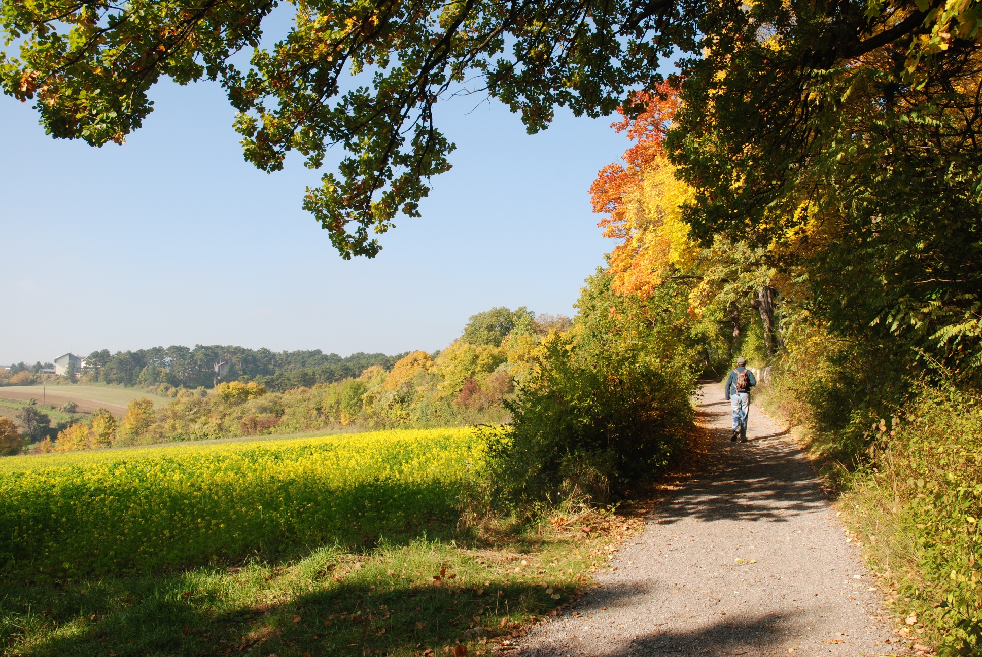
Starting from Enzesfeld, with the Frauentalkreuz being the central meeting point for all feeder routes, you hike westwards along the edge of the forest with great views (including Schneeberg, Hohe Wand), cross the golf road in the black pine forests and can then decide whether to do the tour with or without the summit.
The summit, which is somewhat hidden on the plateau covered in sparse oak forests, has recently been adorned with a summit cross, you can enter your ascent in a summit book and enjoy a rest on the summit bench. The view from the summit, where there used to be a wooden lookout tower, is only partially visible between the trees. On the way back, which leads through beech forests on the north side of the Pfarrkogel, you pass the Pecherhütte, a shelter hut in the forest. All in all, this is a leisurely hike to the highest mountain in Enzesfeld-Lindabrunn.
Standard Hiking Gear
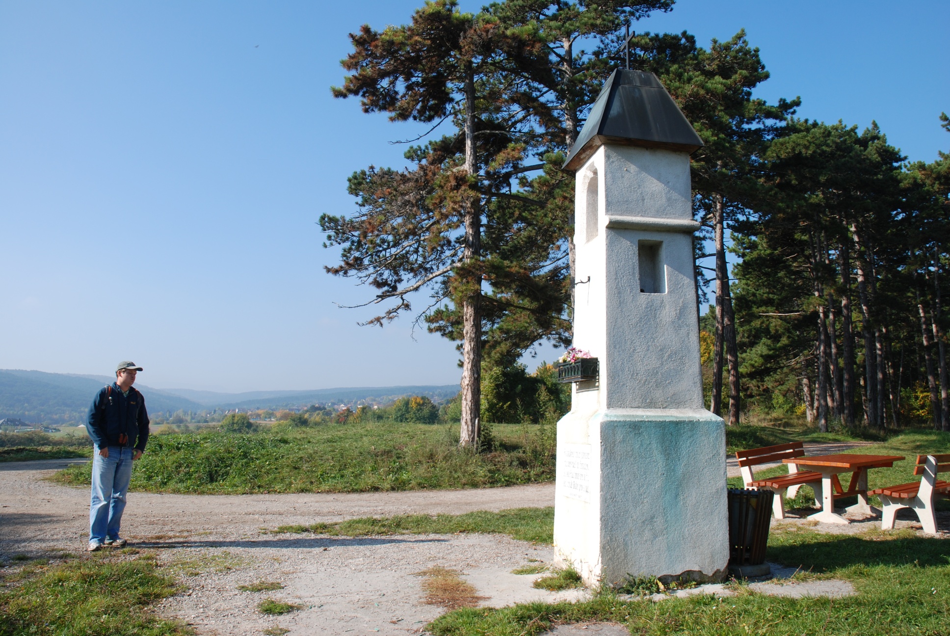
From the parking lot, head south on the road—which is paved at first—until it turns into a gravel road (sign indicating no entry) that runs alongside several stops on the “Path of the Senses” (panoramic sign with a bench, tree information signs) and ascends 300 m to the Frauentalkreuz (335 m) (you can also reach this point from Frauentalgasse and Oberer Weinberggasse). Here, take the flat forest road to the right (west) along the edge of the field, walk past the elevated water tank, and continue straight ahead on a beautiful path with scenic views along the edge of the forest, finally following a stone wall (behind which lies the “Weinar Pond”). The trail eventually turns right into the forest, where, after 10 m, you reach a clearing with an intersection of several forest roads. Take the forest road leading uphill to the left (no-entry sign), which, after a steeper ascent, turns right at a high point. Here, continue straight ahead onto a wide, dirt hiking trail that leads first through the forest, then along meadows behind the former recreation center toward the west. At the end of the wooden fence, you’ll come to a forest road and a trail marked in yellow (= Lindabrunn–Hirtenberg connection). Here, take the forest road straight ahead (unmarked), which climbs gently and winds for 500 m to Golfstraße.
Once you reach Golfstraße, cross it and take the wide forest road across the street (wooden sign on the right side of the tree: “Kreuzerlweg G,” pink arrow “Pfarrkogel”) heading northwest. Follow the unmarked gravel road on level ground for about 200 m until you reach a massive twin beech tree on the right. On this tree, you’ll find a pink arrow marked “Pfarrkogel,” which guides hikers onto a path leading uphill to the right. Now follow the meadow path (pink dots and arrows) uphill, making a left turn and, 100 m further on, a right turn onto a better trail. This trail leads uphill, eventually keeping to the left onto the plateau of the Pfarrkogel. Off the beaten path through the sparse oak forest, following cairns and markers, you’ll eventually find the somewhat hidden summit cross. The highest point of the hike, the Pfarrkogel at 470 m, has been reached (summit cross, rest bench, summit logbook).
After a rest, head directly left past the summit cross and descend steeply along trail marks (cairns) until, after about 50 m, you reach a forest path; follow this 60 m to the right until you reach a forest road. Follow this road downhill, past a left-hand hairpin bend, until you reach a junction. (Here, the forest road joins from the left—the one you branched off from near the large beech tree on your way to the summit. If you don’t want to go to the summit, you could also follow this forest road for 500 m on level ground until you reach this intersection.) At the intersection, turn right onto the forest road; after 150 m, the green-marked hiking trail branches off to the right, leading back toward Hirtenberg. Now follow the beautiful hiking trail (green), which is flat at first but then descends more steeply through the beech forest. The trail joins a forest road, where after 150 m you’ll pass a signpost (green arrows and a sign reading: “Hirtenberg Station, Lindabrunn turnoff”). Note: Do not follow the arrows or the trail markers here; instead, stay on the forest road. Continue on this road for 300 m without any trail markers, until you find the “Pecherhütte” (shelter) 20 m to the right of the path. Continuing on the forest road, a forest road with green markings joins from the left shortly afterward; continue straight ahead (green) on this forest road until you reach Golfstraße after another 500 m. Keep to the right on this road, first through a gentle left curve, past the gate for 300 meters until you reach a sharp right curve. Here, leave the Golfstraße to the left onto a forest trail that leads slightly downhill back to the clearing near the Weinar Pond. Now follow the familiar path along the edge of the forest and past the Frauentalkreuz back to the starting point.
Parking lot at the cemetery or immediately past the funeral chapel
Parking Note: Please follow local parking regulations and check for any parking fees or time restrictions. We recommend checking the parking situation in advance to ensure a stress-free arrival.
A2 South Highway, take the Leobersdorf exit, head toward Enzesfeld, turn right onto Fabrikstraße, turn left across the railroad crossing into the town center, turn right immediately onto Schlossstraße, follow it to Friedhofstraße and to the parking lot
Public Transportation: Enzesfeld train station; walk along the main street toward the town center, past Sport Scharler and Adeg onto Schlossstraße; follow this street to Friedhofstraße and the parking lot
Travel Advice: Please check the route to the meeting point in advance and allow plenty of time. Be aware of possible traffic delays, construction zones, or public transportation disruptions.
There’s also plenty to see in the municipality of Enzesfeld-Lindabrunn. Why not check out the St. Margareta Parish Church or the Lindabrunn Chapel? Of course, there are also other hiking trails and beautiful biking routes. You can find more information about them here!
Updated on: June 9, 2021
Wienerwald Tourism
Hauptplatz 11, 3002 Purkersdorf
Tel.: 02231/621 76
Email: office@wienerwald.info
Website: www.wienerwald.info
Leader Region Triestingtal
Leobersdorfer Straße 42, 2560 Berndorf
Email: office@triestingtal.at
Website: www.triestingtal.at
Letzte Änderung: 6 Aug 2026