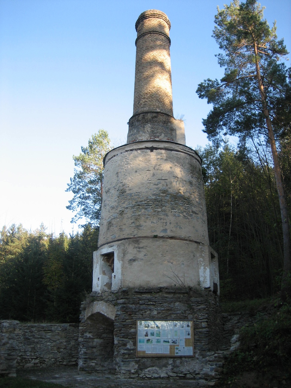
Lime Kiln Trail
Use our AI guide
Do you have any questions about your stay?

Japons lies on the edge of the extensive Saaßwald forest. The church and vicarage rise up on the hill and the village nestles around them. The Saaßwald forest and the many well-maintained paths guarantee relaxation for body and soul for walkers and cyclists. In the Saaßwald forest, you can also take a break at the "Florianibründl" - a chapel with a spring built by a forester Rondonelli in 1808. Along the Thumeritzbach stream, visitors can enjoy a natural landscape that has been preserved in its ecological form and is also popular for youth camps. Also worth a visit is the "Haidlmühle" on the Thaya with bathing and fishing opportunities. Japons has developed into the region's bioenergy village with the expansion of wind power and a biogas plant.
The trail takes you from the outskirts of Zettenreith up a small hill, then through a small forest to the main road toward Zissersdorf. To the left of the road lies the Phyrahof settlement. These so-called “resettlement farms” were provided in 1940 as compensation for the residents displaced by the Allentsteig military training area. Cross the road—go straight ahead down toward Unterthumeritz and turn right through the village. Just outside the village, toward the settlement on the other bank of the Thumeritzbach along the road to Sieghartsreith, stands the lime kiln. Unterthumeritz was the regional center of lime production. The kiln was built in 1904 with three burning chambers and was one of the largest of its kind in Central Europe. The hiking trail takes you back via Oberthumeritz. Almost at the edge of the village, turn right and head uphill toward Goslarn. A) At the edge of Goslarn, turn slightly left onto a dirt road and you’ll return to Zettenreith. Connection to TTW 633 toward Drosendorf. B) Or, at the edge of Goslarn, continue straight along the road to TTW 633 toward Japons.
Vienna: A 22 – Stockerau – B4 to Horn – L 8019 to Japons
Linz: A 7 toward Freistadt – B 310 to Freistadt - B 38 to Karlstift - B 41 to Schrems - B 2 to ÄGöpfritz an der Wild – L 8038 to Ellends – L 60 to the intersection with the L 52 toward Irnfritz to Japons
Attractions:
Japons Bioenergy Village—To sign up for a tour of the biogas plant or a barbecue, contact Mr. Erich Engelbrecht at T 0664/4530183; to sign up for a guided tour along the themed trail, contact Ms. Anita Steininger at T 02914/6455, E steininger@aon.at
Market Town of Japons
3763 Japons 64
T 02914/62 02, F DW 4
gemeinde@japons.at
www.japons.at
WALDVIERTEL Tourism
3910 Zwettl, Sparkassenplatz 1/2/2
(T) +43(0)2822/54109, Fax Ext. 36
Toll-free within Austria:
(T) +43(0)800/300 350
(E) info@waldviertel.at
(I) www.waldviertel.at
Letzte Änderung: 3 Aug 2026