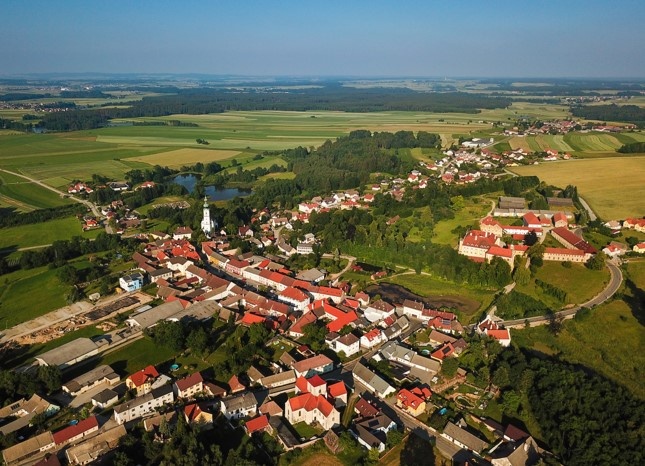
Kirchberg Gmoarunde
Use our AI guide
Do you have any questions about your stay?

The starting point and destination of the cycle tour is Kirchberg am Walde, this is a cycle connection within the villages in the municipality of Kirchberg am Walde.
The starting point and destination of the cycle tour is Kirchberg am Walde, this is a cycle connection within the villages in the municipality of Kirchberg am Walde.
65% of the route is on side roads, 25% on farm tracks and 10% on dirt tracks. Along the route there are wonderful views around the Waldviertel that everyone should/can discover for themselves (e.g.: on the Hinterhaus Güterweg Weissenalbern - distant view of Kirchberg, Langschwarza church, etc.). ...).
50% of the route is on secondary roads, 25% on farm tracks and 25% on country lanes. Along the route there are wonderful views around the Waldviertel that everyone should/can discover for themselves (e.g.: on the Hinterhaus Güterweg Weissenalbern - distant view of Kirchberg, Langschwarza church, etc.). ...).
Signage only in one direction
We recommend wearing a bike helmet. Wear appropriate clothing and sturdy shoes. Think of rain and sun protection. Also bring enough to drink.
Kirchberg - Weissenalbern (turn right in the town center, "Hinterhaus" farm road to the road to Grünbach, farm road to the road towards Schweiggers) - Windhof (farm road) - Sallingstadt - Limbach - Süssenbach - Hollenstein (turn right after leaving town onto the farm road "Roasweg") - Fromberg (via field path) - Ullrichs - Gr. Höbarten - Kirchberg
Details:
The bike route starts at the main square of Kirchberg, where it goes on the state road towards Weissenalbern. In the town center, the farm road "Hinterhaus" goes uphill, where at the EVN water reservoir the highest point of the bike round is reached (magnificent view towards Nebelstein / Czech Republic etc.).
Across the road to the next farm road onto the state road towards Schweiggers.
After the forest, turn left to Windhof, where the farm road straight ahead continues towards Sallingstadt.
From there it continues on the state road to Limbach (chapel), then on towards Süssenbach. Before Süssenbach, then turn right on the farm road "Süssenbach Süd" into the village.
Then it goes on the state road to Hollenstein.
After leaving Hollenstein, turn right onto the "Roasweg" farm road towards Fromberg.
From Fromberg via a field path to Ullrichs.
In Ullrichs, continue on the state road towards Groß Höbarten.
From Groß Höbarten on the state road to Kirchberg, shortly before the town entrance turn right onto the farm road and then (passing by the stud farm) follow the path back to the starting point (main square) of the bike round.
Main square
Vienna - Krems - Zwettl - Kirchberg
Linz - Freistadt - Gmünd - Kirchberg
- Connection to Thayatal and Wasserland bike routes in the route profile
– more information on the municipality homepage or on the GEM2GO App
Market Town Kirchberg am Walde
3932 Kirchberg am Walde, Kirchberg am Walde 7
(T) +43 2854 7010
(E) gemeinde@kirchbergamwalde.at
(I) www.kirchbergamwalde.at
Waldviertel Tourism
3910 Zwettl, Sparkassenplatz 1/2/2
(T) +43 2822 54109
(E) info@waldviertel.at
(I) www.waldviertel.at
Letzte Änderung: 16 Mar 2026