11 Mandelsteinweg
Use our AI guide
Do you have any questions about your stay?

Circular hiking trail no. 11 in Moorbad Harbach
Circular hiking trail no. 11 in Moorbad Harbach
When choosing a route, make sure it’s appropriate for your fitness level. Check to see if the restaurants and cafes you plan to visit along the way are open. Pack your cell phone and maps in your backpack.
Here’s a checklist for your outdoor excursion: to promote considerate interaction with others and responsible stewardship of nature.
Sturdy shoes, functional clothing, sun and rain protection, maps, trekking poles if needed, first-aid kit (blister bandages), plenty of food and snacks (snacks, granola bars, fruit, water).
Please do not leave any trash behind on the trail!
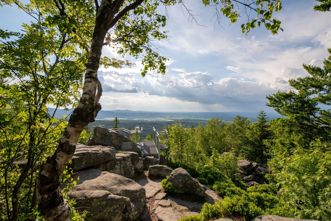
Starting at the town hall in the hiking village of Harbach, you’ll hike along the village toward Mandelstein. After a short climb, you’ll leave the village behind. An old wayside cross stands right at the fork in the trail before you cross the Harbachbach stream. Follow the paved path until it joins a forest road. Follow this road for about 1 km until you reach Mandelsteinstraße. After 350 m, leave the paved road and turn left onto the forest trail to continue hiking up the mountain. After a short distance, you’ll see a signpost on your left pointing to the “Fleischbank”—a worthwhile detour. Just before the summit, the “Rund um den Mandelstein” trail branches off to the right. You should take this loop trail before tackling the “summit climb.” It ends a short distance above the trailhead, and from there it’s just a few steps to the summit cross and the viewing platform. In good weather, you’ll have a magnificent view stretching far into the Böhmerland region. The descent takes you on a leisurely walk through the forest. Don’t miss the turnoff after about 300 meters, and enjoy the magnificent view of Weitra Castle. Right at the crest, you’ll rejoin the paved road and then, after 300 meters, turn left onto the forest path. Follow the trail markers, past the “Hoch über Wultschau” viewpoint, into the village of Wultschau. There, turn right and walk through the village, then turn right again at the end of the village to leave it.
From there, the trail leads slightly uphill back to the village of Harbach. The final stretch of the route follows the “Mein Weg zum Glück” (My Path to Happiness) themed trail, which starts at the Franz Himmer Congress and Event Center. Once you arrive in Harbach, you can enjoy a well-deserved meal at the Landgasthof Binder, the Kirchenwirt, or the “Nepomuk” and reflect on your hike.
The parking lot is located right next to the country road. From the parking lot, it's about 15–20 minutes to the summit.
From Vienna via the A22, S5, B37, and B38; exit the Zwettl bypass at the exit for Weitra. Continue on the L71 toward Heinrichs near Weitra.
Moorbad Harbach Tourism Association
3970 Moorbad Harbach, Hirschenwies 32
(T) +43 680 2382939
(E) info@moorbad-harbach.at
(I) www.moorbad-harbach.at
Waldviertel Tourism
3910 Zwettl, Sparkassenplatz 1/2/2
(T) +43 2822 54109
(E) info@waldviertel.at
(I) www.waldviertel.at
Letzte Änderung: 3 Aug 2026