Wald-Weinviertel Trail 663
Use our AI guide
Do you have any questions about your stay?

Rosenburg - Maria Dreieichen - Sigmundsherberg - Pulkau - Europawarte - Retz
Rosenburg - Maria Dreieichen - Sigmundsherberg - Pulkau - Europawarte - Retz
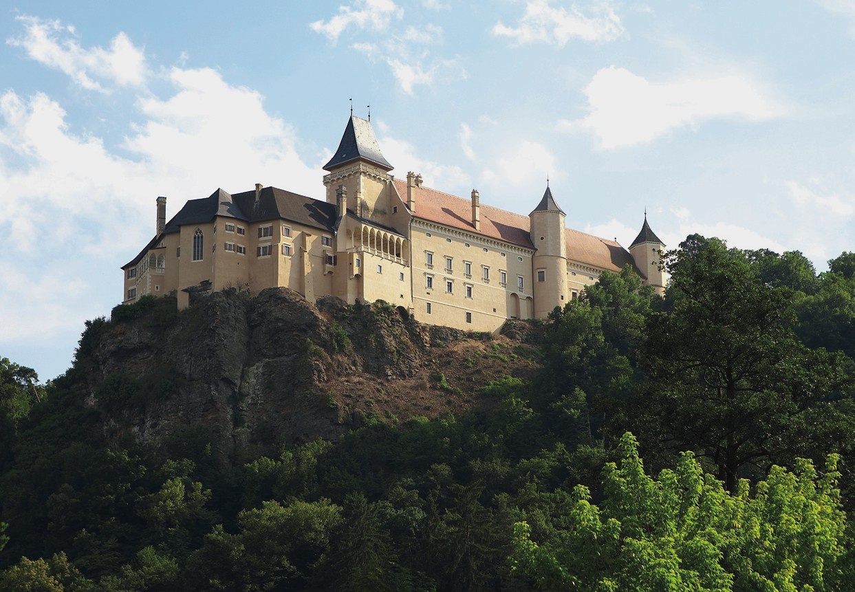
The trail begins in Rosenburg across from the train station. At first, we walk slightly uphill along some steps to the chapel, then continue to the right along the ridge trail. After more than 1 km, the trail leads us downhill to the road. Keeping to the left, we turn left again after crossing the road bridge. Along the left bank of the Taffa River, the trail leads us to the narrow paved access road to the Rasch Mill. There, we keep to the right and, after 300 m, cross the Horn-Rosenburg road. We continue along the road toward Mold, but leave it after 400 m by turning right. The trail continues along a paved farm road, crossing the railroad tracks and the Sacherbach stream. 200 m past the small bridge, take a sharp left again, first passing a small grove of trees, then across fields all the way to Mold. In Mold, we cross the main road, and between the fire pond and the transformer, the trail leads uphill through fields to Maria Dreieichen. Looking back, the view extends all the way to the Alpine foothills. After a short stretch through the woods, we arrive at the pilgrimage church, the Basilica of Maria Dreieichen.
Passing to the right of the church, the trail follows the Stations of the Cross downhill to the Bründl Chapel and the Grasl Cave. Note: On this section of the trail, we follow a regional hiking trail marked white-red-white all the way to Rodingersdorf. We hike to the right of the chapel, initially ascending briefly through a beautiful forest, partly along the forest edge, and after 2.5 km we reach the Jägerkreuz and then cross the railroad tracks. Soon after, we leave the forest and reach a dirt road, passing abandoned sand pits on our way to the new wayside cross on the Rodingersdorf–Klein Meiseldorf road. We cross this road and enter the village of Rodingersdorf, which we soon leave again, keeping to the right. We now arrive in Sigmundsherberg and hike along the main street. We head toward the church, pass to the right of it until we reach the road to Brugg, continue 150 meters to the left on this road, and after the elementary school, turn right onto a farm road. We follow this path straight ahead for about 1.5 km to the edge of the forest, then continue on a beautiful forest trail to the weather cross. Here we reach the Sigmundsherberg–Missingdorf road and, after a few steps, immediately turn left again onto a forest trail. After about 15 minutes, the forest ends and we enjoy our first view to the east toward the Weinviertel. The view extends all the way to the Leiser Mountains, 50 km away. On very clear days, you can see the
Pöllauer Mountains in the Czech Republic. We continue hiking to the Mossingdorf-Theras road, walk a short distance to the left, and shortly afterward turn right off the road into the forest. We continue along the edge of the forest until, a little later, we descend into the Pulkau Valley. Passing the ruins of “Niederneudegg” and the hammer mill, we continue along the sandy road until we reach a small footbridge.
We cross the bridge and continue along the right bank to the road, cross it, and walk past the Waldbad, always following the stream bank, until we enter the town of Pulkau.
In the center of Pulkau, we walk past the town hall on the left, heading uphill toward Leodagger. At house number 12, we turn right onto the footpath and walk to St. Michael’s Church. We turn left and cross the road toward Leodagger. As we walk along the farm road—which is paved at first—we can already see Leodagger and Waitzendorf on our right, and the Europawarte on the horizon beyond Leodagger. We reach the Pulkau-Weitersfeld state highway, cross it, and walk along dirt paths through the vineyards toward Leodagger. After 200 m on this dirt path, we turn right and, after another 50 m, turn left again, arriving in the village of Leodagger and at the village chapel. To visit the “Kalendersteine,” we turn right onto the road toward Waitzendorf. After 50 m, we see the sign and turn right again through a garden to the “Kalendersteine.” Now we retrace our steps and continue along the road toward Passendorf. We hike along the sandy road until we reach a “waycross.” Caution—from this waycross onward, the landowner has removed the trail markers, so the
direct path to the Europawarte must be taken unmarked.
At the wayside cross, take the right-hand forest path uphill to the “Guardian Angel Chapel” and on to the “White Cross.” From here, take the middle path and, after about 500 m, cross the intersection straight ahead. We walk through oak forests until we reach the fields. The path, which is still unmarked, leads us along the edge of the forest to the Untermixnitz–Waitzendorf road. From here, the trail is marked again. We walk about 800 m to the right on the road until we reach the “Europawarte” turnoff —it’s worth climbing the Europawarte – St. Benediktswarte (471 m above sea level, 26 m high with a 6-meter-high cross) for the magnificent view.
From the lookout, take the wide path back to the road, follow it downhill for about 100 m, and then turn left into the forest. We then follow the circular hiking trails 21/3 and 21/4 to Ober-Markersdorf and walk along the main street to the left until we reach City Hall. There, we turn left across the stream and continue along the left bank to the fire pond. From here, continue 170 m along the road, then turn left onto a farm road and, after 200 m, turn left again onto a footpath along the stream. Cross the stream twice and rejoin the farm road.
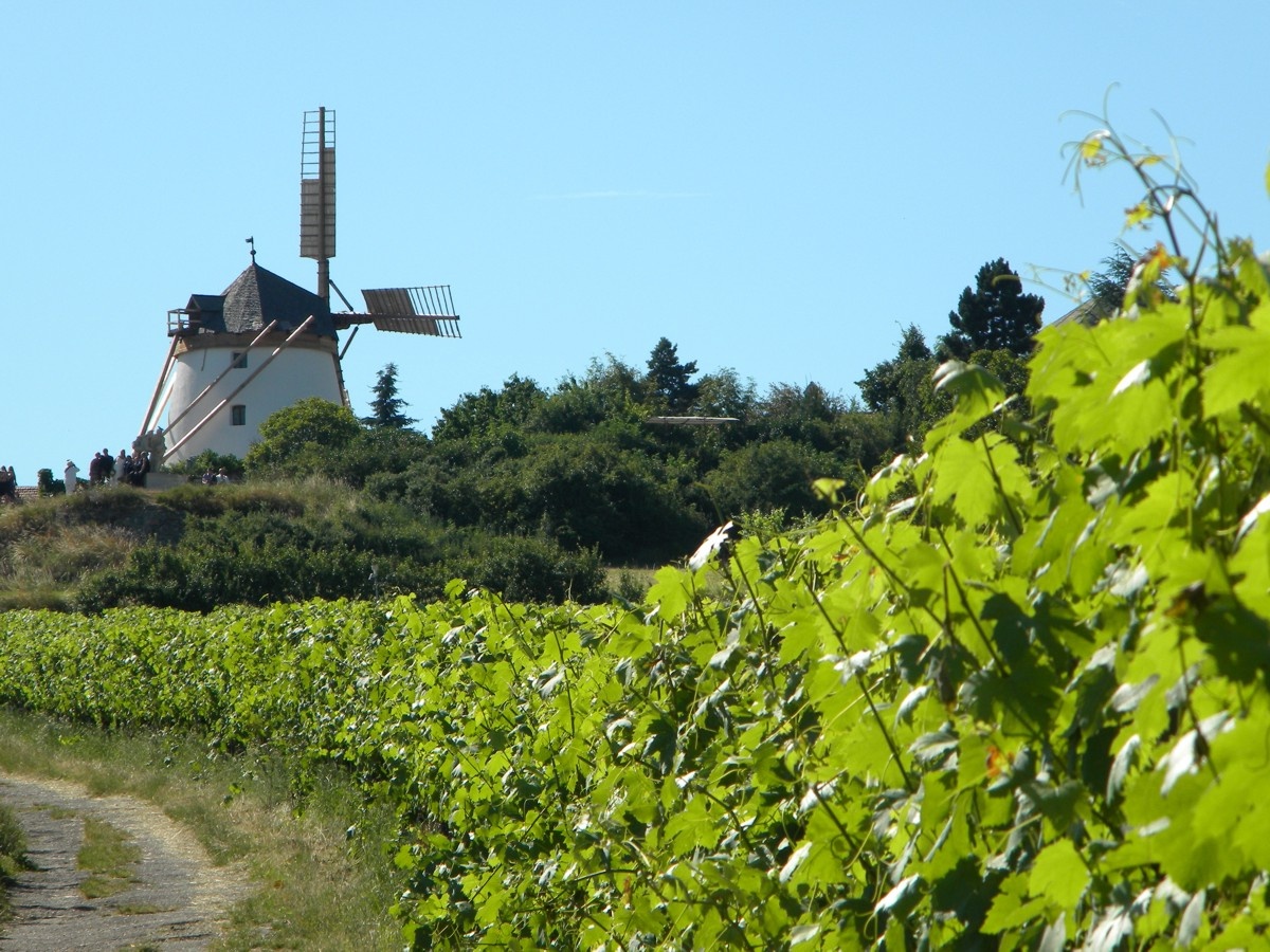
Passing wine cellars and wine press houses, we continue walking through the vineyards—looking toward the northeast, we can already see the Retzer windmill. We reach the road and walk about 130 m to the right before turning left onto a dirt path. After 150 m, we keep to the right and hike to the Jägerkreuz, where we reach the road to Hofern. We turn left onto the road, walk 800 m to the edge of the forest, and continue along the dirt road to the right. After about 15 minutes, we spot a small hill on the right with the “Hängender Stein” (Hanging Stone). The path leads us slightly downhill through a sunken path toward Obernalb. Just before the village, we turn left and then right again after 200 m. On a narrow paved road, we come to a wayside shrine bearing the date 1539. A short distance further on, to the left of house No. 157, we walk slightly uphill toward the quarry, which we’ve been able to see to the north for some time now. We pass to the left of the ÖAMTC recreation center, continue through a small acacia grove, and head up a hill with a beautiful heath-like landscape; to the left, we can already see the windmill, which we’ll reach in a few minutes. Right next to it lies a remarkable war memorial. We now have a beautiful view to the west toward the foothills of the Waldviertel, and to the east toward the town of Retz and the Weinviertel plain. In 15 minutes, the trail leads us downhill to the town center of
Retz.
Directions to Retz: By car from Vienna: Take the A22 highway to Stockerau, then continue via Hollabrunn to Retz
Directions to Rosenburg:
By car from Vienna: Take the A22 highway to Stockerau (exit toward Horn), then take Federal Highway B4 to Mold; turn left at the town exit
By car from Salzburg, Linz, or St. Pölten: Take the A1 highway to St. Pölten (exit toward Krems), then the S33 expressway to Krems (continue toward Horn), and finally the B34 highway to Rosenburg.
By train from Vienna: Franz-Josef-Bahn to Sigmundsherberg Station, then the Kamptalbahn to Rosenburg Station
By train from Salzburg, Linz, or St. Pölten: Westbahn to St. Pölten Station, then the Kamptalbahn via Krems and Hadersdorf to Rosenburg Station
For more information, visit http://www.alpenverein.at/horn_wAssets/mixed/wanderwege/WALD-WEIN.pdf
Austrian Alpine Club
Horn Section
(T) +43 664 823 94 07
(E) horn@sektion.alpenverein.at
(I) www.alpenverein.at/horn
Waldviertel Tourism
3910 Zwettl, Sparkassenplatz 1/2/2
(T) +43 2822 54109
(E) info@waldviertel.at
(I) www.waldviertel.at
Letzte Änderung: 3 Aug 2026